- Wed 25 April 2012
- Cartographica
- Rick Jones
- #gps, #gpx, #trail
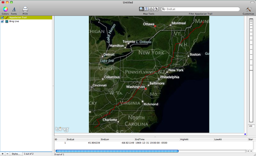
The Appalachian Trail is a hiking trail in the Eastern United States that ranges from Springer Mountain, Georgia and Mount Katahdin, Maine. The trail is more than 2,000 miles long and it passes through more than 14 states. The trail includes numerous locations for viewing sights, camping, and lodging and typically takes several months to hike. The website TopoFusion has .gpx data that can be downloaded and imported into Cartographica to map the Appalachian Trail. The TopoFusion website says that the data are designed to be uploaded to GPS devices. gpx files can be imported by connecting your GPS device to you computer or by downloading .gpx files from another source like the internet or a local network. Download the at_full_gpx.zip file from the TopoFusion website and then import it into Cartographica by choosing File > Import Vector data. Also, add a live map by choosing File > Add Live Map. I show my map below.
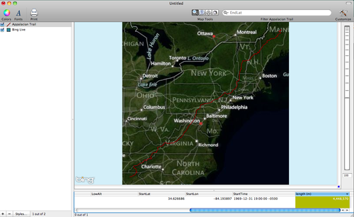
The .gpx file contains some data related to the location of the start and end of the trail. However, we can add additional information to further enhance the .gpx file. To add a length column that will contain the data on the length of the trail choose Tools > Add Length Column and then check the data viewer for the added column.
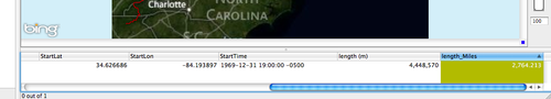
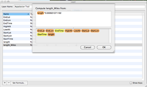
Notice that the length is given in meters. To convert the length to miles you can create a new column by choosing Layer > Add Column. Next, you can assign an equation to the column by choosing Window > Show Layer Info. In the Layer Info widow find the new column and rename it "length_Miles". I show an image below of the set up.
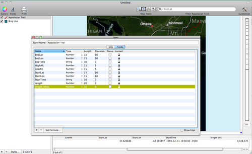
Next, we can convert the length in meter column to length in miles by setting the formula for the new length_miles column. To set the formula click on the Set Formula button and then multiply the length column by 0.000621371192. To find the number to use for the conversion between meters and miles I did a google search and found the conversion. Once complete, click OK. I provide an image below of the Set Formula window.
You can check to see the conversion in the length_miles column in the data viewer at the bottom of the data viewer. I provide an image of the data viewer below. The conversion shows that the trail is 2764 miles long, which matches the lengths I have seen in publication on the Appalachian Trial.