- Fri 17 July 2009
- Geo Data
- Rick Jones
- #tornado
I was attempting to find some Climate Change data when I came across GeoData.gov ,which is a really excellent website for free GIS data. When I was attempting to find climate data I came across some very interesting data regarding tornados in the United States. The data included an entire log of tornados from 1950 through 2006 which includes nearly 50,000 data entries.
The tornado data includes a lot of information about each event including the strength of the tornado on the F-Scale, the number of injuries and deaths, how far the tornado went, how wide the path was, and of course the date that the tornado occurred. I thought this type of data would provide a really good opportunity to show some more of Cartographica's analysis capabilities so I played around with the data and I am including some screenshots of what I found with the data analysis. For the examples, I have created a Kernel Density map of all of the tornados from 1950-2006, in order to determine where the most tornados have occurred over time. Also I filtered out the the F-5 tornados and created a convex hull so that we can get a good picture of where the strongest tornados have occurred over time. The most interesting and useful aspect of this data, is that it has been collected over a very long period of time, which means that it is likely a very good illustration of where tornados are most likely to occur. I have included an image of where Tornados Alley, borrowed from Wikipedia, which can compared that to the data presented in Cartographica to see if the data we are presenting matches this general area of the country. By a simple visual comparison, it appears that the map of Tornado Alley is supported by the Kernel Density map created in Cartographica.
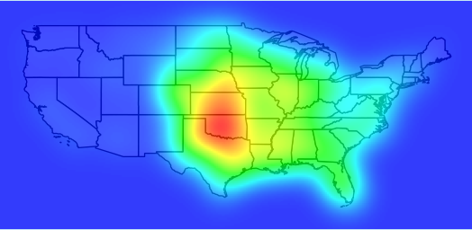 |
Screenshot of KDM of Tornados from 1950-2006 |
 |
Screenshot of Convex Hull around all F-5 tornados from 1950-2006 |
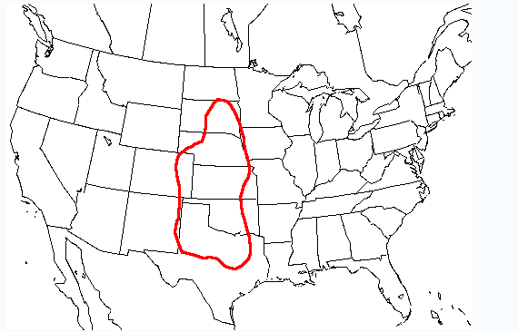 |
Tornado Alley |