- Wed 15 July 2009
- Featured Maps
- Rick Jones
I found a really interesting website earlier this week that is used for tracking marine vessels around the world. The website, MarineTraffic.com provides a look at most (but not all) coastal areas around the world that have large ports and heavy sea traffic. The website gives the location of a ship on a map by providing a symbol that corresponds to the type of ship that is being represented. The user can click on the symbol and learn a lot of information about the ship, like where it is from, where it is going, what its job is (i.e. towing), how fast it is moving, and in many cases can even see a photo of the ship. Additionally, the user can search for specific vessels that are currently docked or underway, and can look up specific ports that they might be interested in.
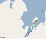
I am a fan of the TV show Deadliest Catch so I thought it would be pretty cool to check out Dutch Harbor which is the place where many of the ships drop their fishing loads during the crab fishing season. There are several ships heading in and out of Dutch Harbor, but none of the ships familiar to the show are present on the map. I am providing a few screenshots of the website so that users can get a feel of what it looks like. I would recommend going to this website if you are interested in sea traffic, or if you are just looking for a few minutes of interesting entertainment.
 |
Screenshot of Dutch Harbor |
 |
Screenshot showing a selected ship |