- Wed 21 July 2010
- Cartographica
- Rick Jones
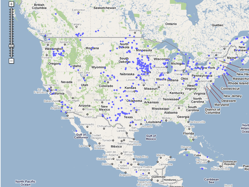
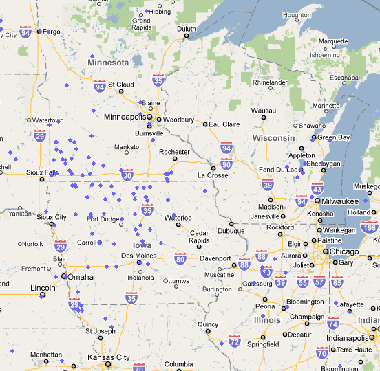
The rising cost of energy has left many countries around the world in search of alternative sources of energy that are more environmentally friendly and cheaper than carbon based fuels. The expansion of renewable energy sources has many applications to GIS. Mapping can be used to determine the best places to install energy sources such as wind and solar, and can also be used to monitor where these types of power plants are located.
In an attempt to find data highlighting the location of wind farms in the U.S. I stumbled across Wind Energy Database, which has a lot of information about the wind energy industry. The website includes statistics on the growth and production of wind farms, and includes maps that allow users to observe where wind farms are located in the U.S. In addition to the location of wind farms users can click on links that provide information on each of the wind farms. The information includes how many turbines are on each farm, how much power is produced, and who is the owner/operator of the farms. The Wind Energy Database is a great source of information about wind farms in the U.S. and worldwide and I think many of Cartographica's users will find this website to be very useful. I have included a few screenshots of the website's mapping capability.