- Mon 10 August 2009
- Featured Maps
- Rick Jones
I recently completed a paper on the relationship between a governmental program known as HOPE VI and changing crime patterns in Lexington, Kentucky. I discovered some very interesting patterns that occurred as large numbers of public housing residents were relocated throughout the city. The methodology for this study was somewhat more complex than simply comparing a few maps over several years. I employed various statistical techniques to determine if the presence of HOPE VI residents could significantly predict higher rates of crime and social disorganization. For this post I am including the maps that show a significant growth away from the center of Lexington out toward areas where HOPE VI residents relocated.
The findings of the study indicated that as the number of HOPE VI residents in a city block group increased the likelihood that the block groups would have high levels of social disorganization and crime would also increase. The social disorganization construct was created based on numerous variables that have been well documented to be associated with poor neighborhood conditions and crime. The purpose was not to point out that HOPE VI residents were causing crime (although there is a temporal relationship) because the data I used could not substantiate that claim. Instead, the purpose was to show that with better use of available resources ( i.e. U.S. census data) that we might be able to avoid problems that are related to displacing troubled populations.
A limitation of the study was that I did not have data to show that HOPE VI residents stayed in their new neighborhoods over time, which is important because it prevented me from attempting to infer causation between the presence of HOPE VI residents and increasing crime. However, what can definitively be said is that at the time of the relocations (at the end of 1999), the neighborhoods that HOPE VI residents moved to were significantly more socially disorganized, and that the level of crime in the neighborhoods became worse over time. In analyzing the crime data it is my opinion that the neighborhood that the residents moved to were already in a state of decline, which is supported by the fact that the neighborhoods were significantly more likely to be socially disorganized at the time of the relocations. The following maps show where the residents relocated, how crime increased in those areas over time.
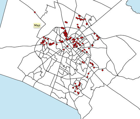 |
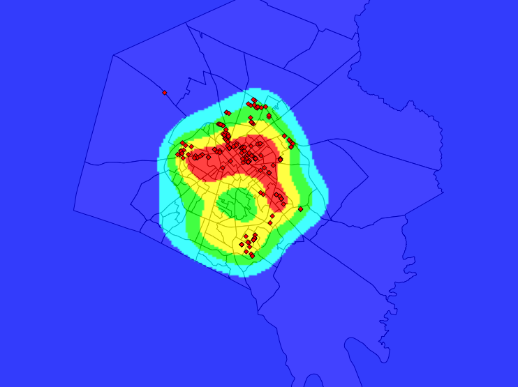
Screenshot of HOPE VI Relocation Locations |
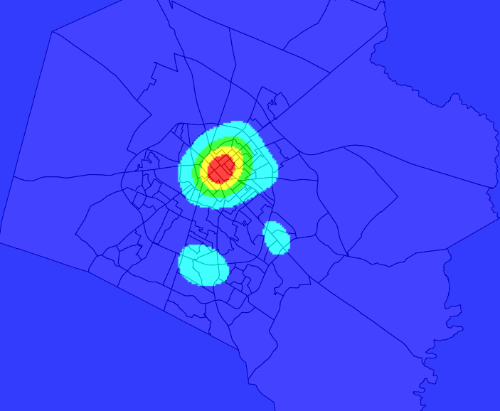 |
Crime in 1995 |
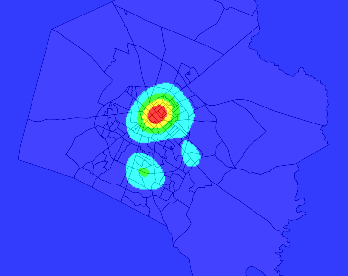 |
Crime in 1999 |
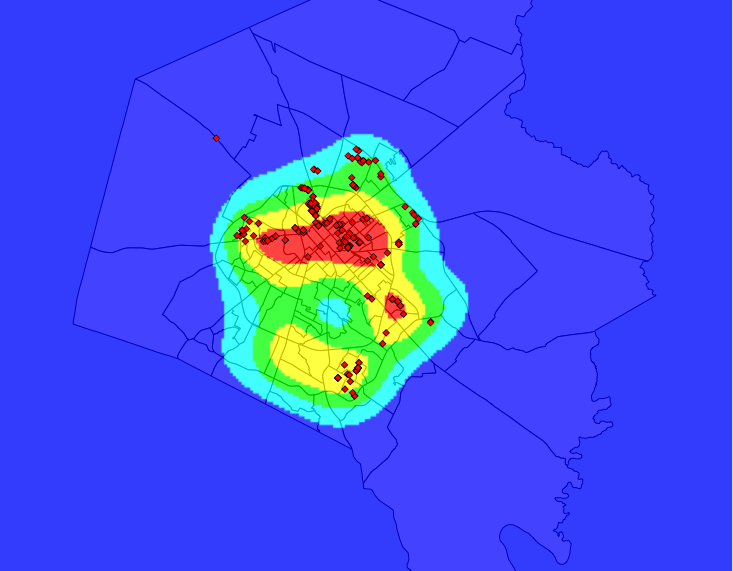 |
Crime in 2001 with Relocation Overlay |
 |
Crime in 2005 with Relocation Overlay |