- Tue 10 January 2012
- Cartographica
- Rick Jones
The highly anticipated Republican Presidential Primary is being held today in New Hampshire. The New Hampshire Primary is a particularly important election because it is the first non-caucus election held for the run up to the Republican presidential nomination and the subsequent Presidential election. The election receives a lot of media attention and is used as a tool for analyzing and estimating the performance of elections held in other states.
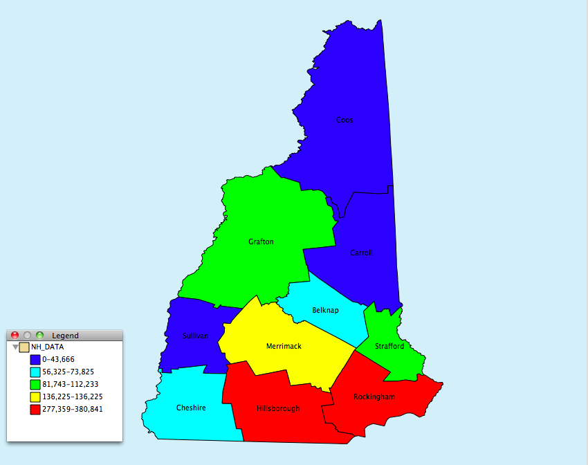
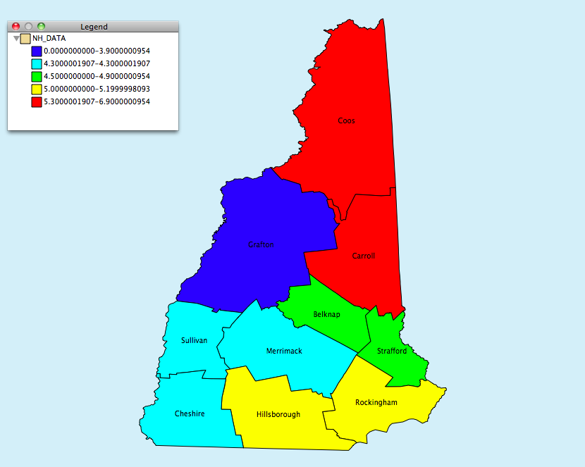
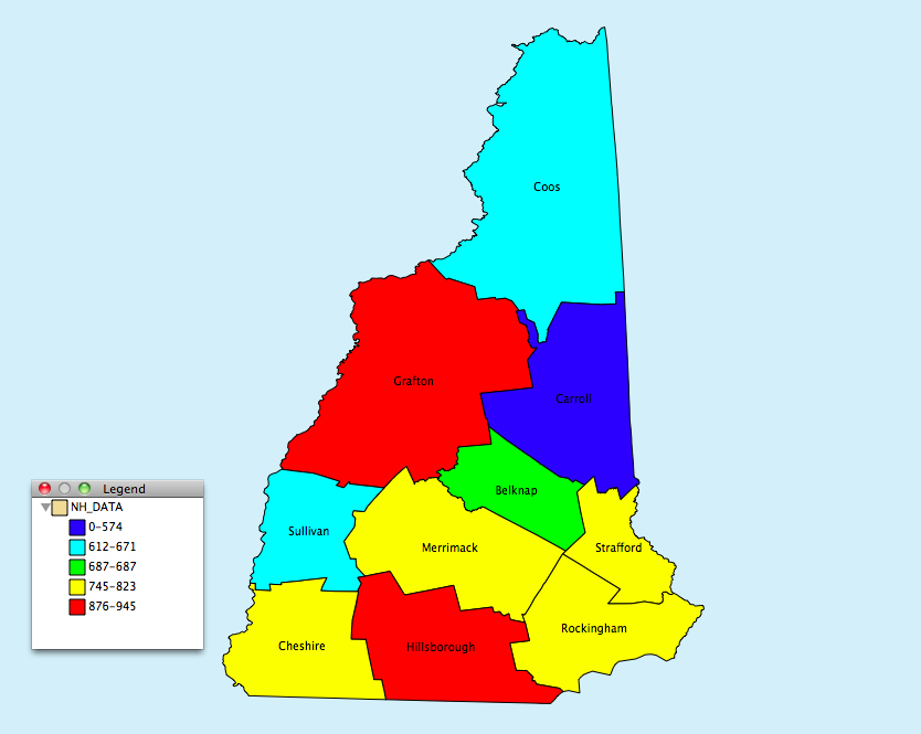
To honor the New Hampshire primary I have put together a data set with data collected from several sources. The dataset includes data from the American Fact Finder website, which is a service provided by the United States Census Bureau. The data included in the dataset are from the 2010 U.S. census and include basic demographic data about counties within New Hampshire. The variables include the total population, total white and total black populations.
In addition to the census data I also collected data from the Bureau of Labor Statistics. The variables collected from the BLS was the average weekly income, unemployment, employment, and total labor force variables. Unemployment and earnings have been a particularly important issue given the recent economic and are interesting data to explore for this election.
Also I collected data on the last presidential election in New Hampshire from the The New York Times. The variables collected from the Times includes the total votes cast for each candidate and the percent of the total vote that was given to each candidate.
The geographic data for New Hampshire were also collected from the U.S. Census Boundary Files website.
To combine these sources of data I created a .csv file and used Cartographica's ability to import table files. The steps for combining the boundary file and the .csv file are…
-
Import the Boundary file to the map
-
Choose File > Import Table Data...
-
Choose the
New Hampshire.csvfile, or the file you want to import -
Click on the Join tab
-
Change the Target Layer option to New Hampshire
-
The next step identifies a unique identifier used to link the boundary file to the .csv file. To link the two dataset each county is assigned a unique identifier, which is contained in both data sets. In the New Hampshire file we can use the County name as the link. To do this Check the box under the Key column in the County row.
-
Then click Import
I have provided a few maps of the variables that are included in the dataset below. Also we will provide the New Hampshire data set so you can do more exploring on your own.