- Mon 04 February 2013
- Cartographica
- Rick Jones
- #environment, #raster, #vector
Fracking has become a hot button topic among environmentalists and politicians over the past 10 years. Shale Gas is a type of natural gas found deep within shale rock formations. In 2000 shale gas provided only 1% of U.S. natural gas production; by 2010 it was over 20% and the U.S. government's Energy Information Administration predicts that by 2035 46% of the United States' natural gas supply will come from shale gas (Wikipedia, 2013). There is significant debate about whether fracking should be increased to these levels due to the environmental risks associated with the fracking process.
Opponents of fracking argue that the extraction and use of shale gas can affect the environment through the leaking of extraction chemicals and waste into water supplies, the leaking of greenhouse gasses during extraction, and the pollution caused by the improper processing of natural gas.
A challenge to preventing pollution is that shale gas extractions varies widely in this regard, even between different wells in the same project; the processes that reduce pollution sufficiently in one extraction may not be enough in another (Wikipedia, 2013). However, proponents of fracking argue that shale gas represents a significant improvement when compared to other fossil fuels, and may even help stem growth in greenhouse gases. Also, shale gas and the associated industry can greatly improve the United States' ability to become energy efficient and self-sustaining.
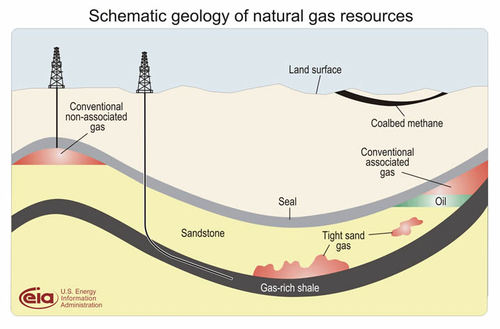
No matter your perspective on this issue it may be of interest to you to find out where fracking and the related industries are taking hold in the U.S. In this post we use data from U.S. Energy Information Administration. The image below shows the basic idea behind fracking.
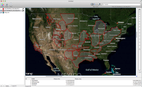
The first map below shows the shale basins within the U.S. These are areas where there is enough shale gas fracking to occur.
-
To download this data click on the EIA link above and then scroll down about half way down the page until you see the "Geospatial Data in Shapefile (.shp) Format".
-
Click on the the Shapefiles for Basin Boundaries under the Data for Shale Plays Map heading.
-
To import the data choose File > Import Vector Data
-
To add the live map as a basemap choose File > Add Live Map
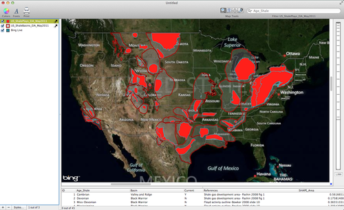
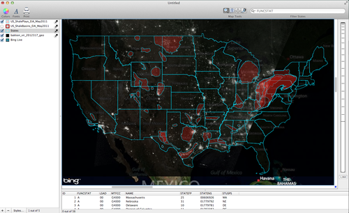
- The second map below show the areas known as Shale Plays, which are areas that have shale gas currently being harvested using fracking. The areas being harvested are dark red.
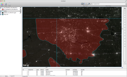
Recently, fracking made the news when NASA released satellite imagery highlighting the growth in fracking in undeveloped areas around the country. Specifically, NASA highlighted the growth in nighttime lights in the North Dakota region, which is a relatively undeveloped part of the county. Despite the low levels of development there are significant nighttime lights visible in areas where shale gas fracking operations are underway.
-
Download a Geo.tiff image created by the Visible Infrared Imaging Radiometer Suite (VIRUS).
-
Once you download the image you can import it into Cartographica by choosing File > Import Raster Data. Below is an image showing the geo.tiff with the Shale Plays layer.
And a closer look at the increased nighttime lights due to fracking operations in North Dakota.