- Tue 01 June 2010
- Tips and Tricks
- Rick Jones
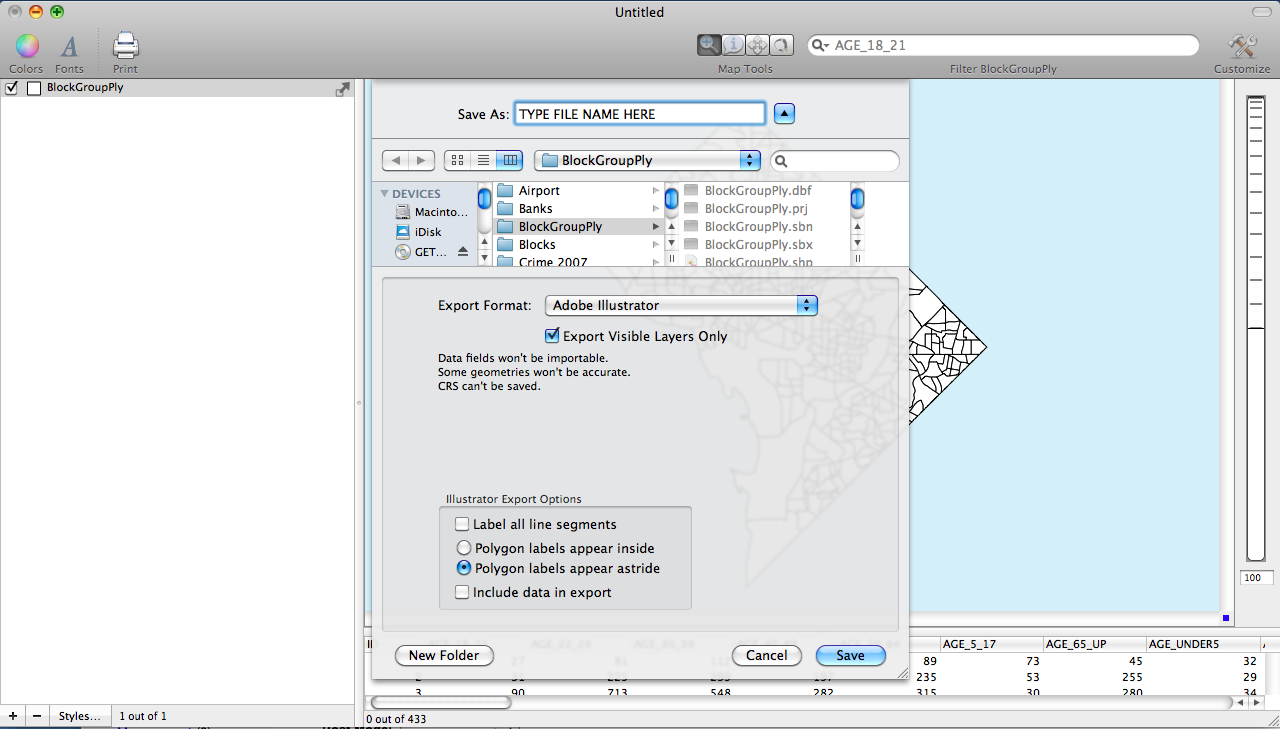
Exporting maps to Adobe Illustrator gives you the ability to enhance GIS output for presentation and publication. Cartographica 1.2 offers new enhanced features that give more specificity in what is exported to Adobe Illustrator from Cartographica. The new features give you the ability to choose line segment labels, to determine how polygons will be labeled, and it gives you the choice to export data along with the map. The segment labels option gives you choice in labeling lines with multiple segments. You can choose to label each line segment of label only the first segment. Also you are able to chose whether polygons will be labeled internally or if the label will be next to the polygon. Finally, you have the choice to export data along with the map, which give you the ability to do extra enhancements once inside Adobe Illustrator. The enhanced features of exporting files means that Cartographica is very adaptable to your needs in terms of what you want to be exported to Adobe Illustrator.
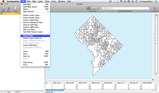
Below is an example of how to export you map to Adobe Illustrator.
-
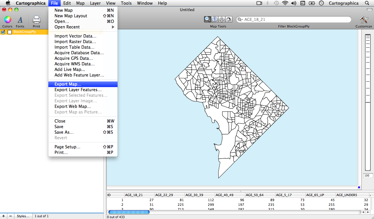
The first step in exporting to Adobe Illustrator is to choose File > Export Map\
-
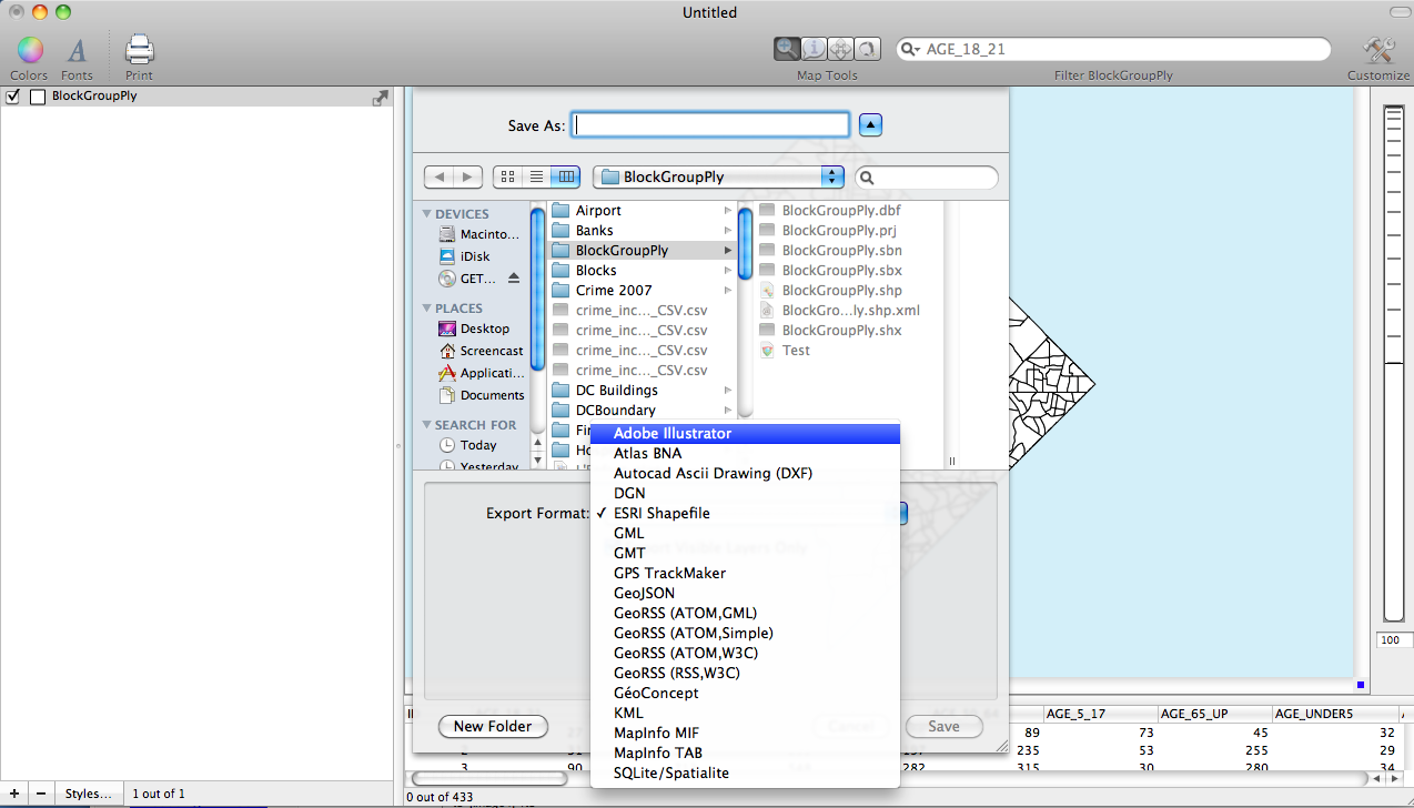
The second step is to choose to export to Adobe Illustrator\

-
The third step is to save the file as an Adobe Illustrator File. Notice in the screen shot below that there are options to select in the bottom section of the save window. These options are new to version 1.2 and are the new features described above.\