- Thu 19 January 2012
- Cartographica
- Rick Jones
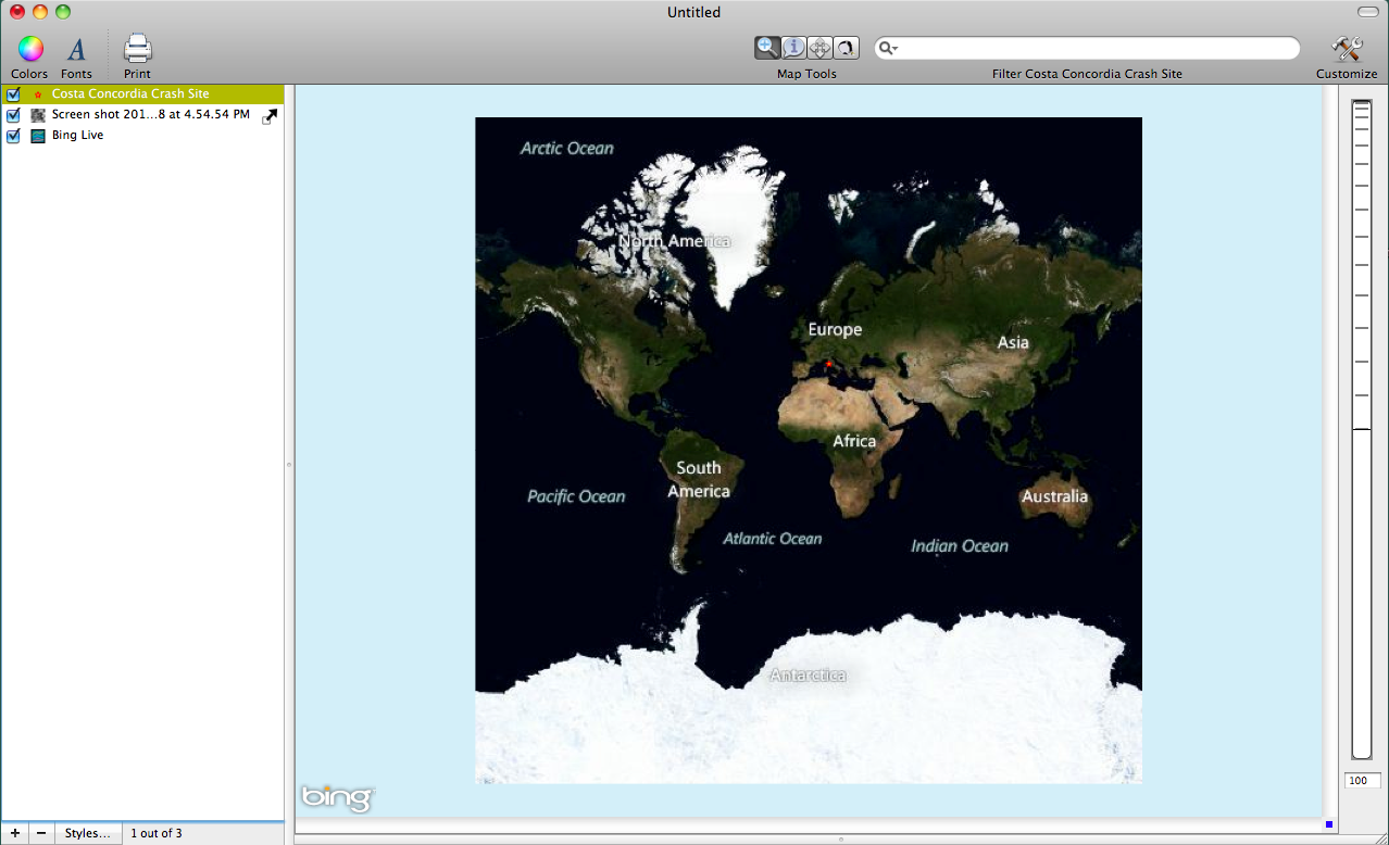
This post shows an image downloaded from Digital Globe that depicts the wreckage site of the Costa Concordia cruise ship. The ship wreck occurred off of the coast of Italy and is still currently being handled by officials there. There has been much media attention given to ship's captain who mysteriously abandoned ship before many of the passengers. He was taken into custody by Italian officials. For this post, I georeferenced the Digital Globe image using Cartographica so that we can create more informative maps and new data layers.
The first step in using an image like the one downloaded from Digital Globe is importing it into Cartographica as a raster file and then georeferencing using a reference map like the one provided though the Bing Live Maps feature.
To import the image into Cartographica choose File > Import Raster File....
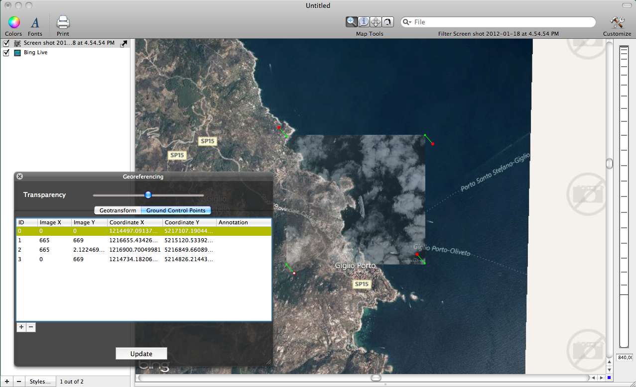
The layer will appear in the Layer Stack. Click on the image layer and then choose Edit > Georeference Image.
The next part of georeferencing the image is as much art as it is science. The georeferencing process involves first finding the general location of the image on a reference map using zoom tools. Then use the Fit Display button within the Georeference Image window, to provide a general first fit of the image to the reference map. Next, use Ground Control Points to more precisely match the image to the reference file. The reference file can be either be a Bing Live Map, which is provided in Cartographica, or another shapefile or raster file that is already georeferenced. For this example I used the Bing Live Map to georeference the image. I provide some screenshots below...
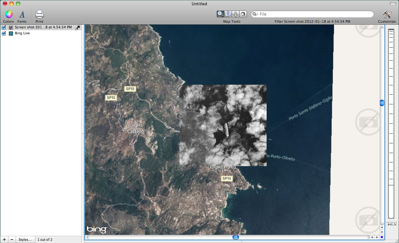
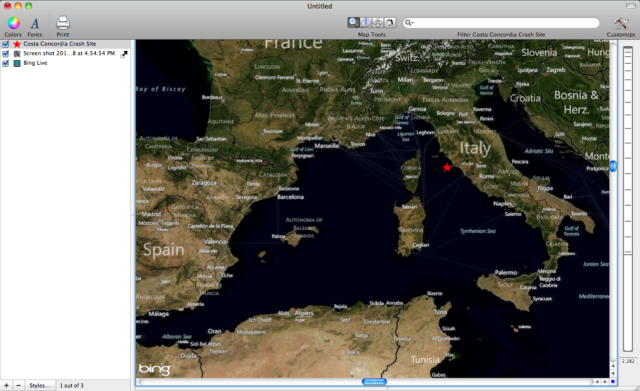
An advantage of georeferencing an image like the provided by Digital Globe is that it allows you to visualize the image alongside data from other sources. For example, the images above show the wreck site compared to features beyond the scope of the original image. This allows you to further contextualize the incident location. Also by georeferencing an image to a map it allows you to create other types of data layers based off of the satellite imagery. For example, the image of the crash site provides a very accurate depiction of where the crash site is located. Using this information I can quickly create a new shapefile from the image.
To create a new layer click the plus button at the bottom of the layer stack. Then choose Edit > Add Feature. For this example I chose to create a new point file which allows me to indicate where the crash site is on a larger map with a single point.