- Fri 15 February 2013
- Cartographica
- Rick Jones
- #environment, #vector
iLoveMountains.org is an organization that, "is the product of 14 local, state, and regional organizations across Appalachia that are working together to end mountaintop removal coal mining and create a prosperous future for the region." Together this group provides information and research to the public about the problems that mountain top removal mining has cause, and continues to cause in the Appalachians.
According to iLoveMountain.org, "Mountaintop removal is a relatively new type of coal mining that began in Appalachia in the 1970s as an extension of conventional strip mining techniques. Primarily, mountaintop removal is occurring in West Virginia, Kentucky, Virginia and Tennessee. Coal companies in Appalachia are increasingly using this method because it allows for almost complete recovery of coal seams while reducing the number of workers required to a fraction of what conventional methods require."
Part of the problem with mountain top removal is that the processes is destructive to the environment and the local habitats in the area where the mining is occurring. "Before mining can begin, all topsoil and vegetation must be removed. Because coal companies frequently are responding to short-term fluctuations in the price of coal, these trees are often not even used commercially in the rush to get the coal, but instead are burned or sometimes illegally dumped into valley fills" (iLoveMountains.org). Additionally, "While reclamation efforts such as stabilization and revegetation are required for mountaintop removal sites, in practice, state agencies that regulate mining are generous with granting waivers to coal companies. Most sites receive little more than a spraying of exotic grass seed, but even the best reclamation provides no comfort to nearby families and communities whose drinking water supplies have been polluted and whose homes will be threatened by floods for the hundred or thousands of years it will require to re-grow a forest on the mined site" (iLoveMountains.org).
The problem that iLoveMountains.org is attempting to combat is inherently a spatial problem, and due to this fact they disseminate a lot of interesting spatial data to help promote additional research and understanding by the public. To help highlight the problem that they are pointing out this blog post uses a number of the dataset provided to create maps and help visualize the problems. To download the iLoveMountain.org data visit their data download webpage.
Before importing any of the data, first add a Live Map by choosing File > Add Live Map. This will provide a basemap and will allow you to see what the mountain top removal sites look like based on satellite imagery. Additionally, a shapefile of U.S. States was imported by choosing File > Import Vector Data to more clearly show the state boundaries in the area. Download the states shapefile at the U.S. Census website. Once the basemaps are imported you can import each of the shapefiles provided by iLoveMountains.org by choosing File > Import Vector Data.
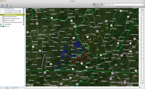
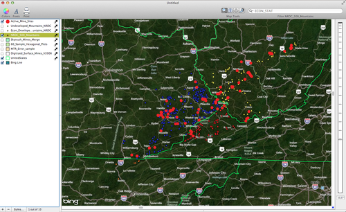
The first map below shows all of the mountains that are being or have been mined in the Appalachian region. This is the NRDC_500_Mountains layer. The mountains have been color coded to indicate the states that they are within. To color code the mountains double-click on the mountains layer in the layer stack, change the based on option to state, click on the gear box and select Distribute Unique Values (4), and then assign colors to each of the categories.
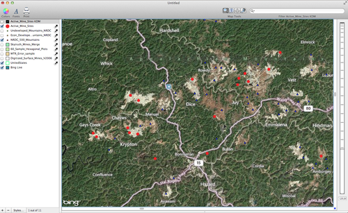
The next image shows all of the active mines in the region. This is the Active_Mine_Sites layer. The large red points are the active mine locations.
The next image is a Kernel Density Map of the Active Mine sites. To create a KDM select the Active_Mine_Sites layer in the Layer Stack and then while holding down the option key choose Tools > Create Kernel Density Map. Select the Visible Area option and then click Analyze.
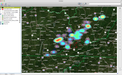
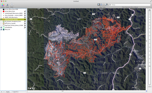
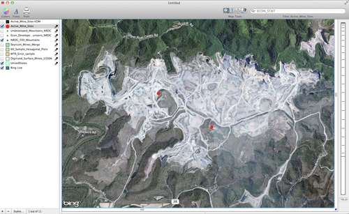
The next image is a look at the satellite imagery of the largest hot spot located in Southeastern Kentucky. Notice the large gaps in the tree canopy.
And a closer look at a large mine near Lamont, KY.
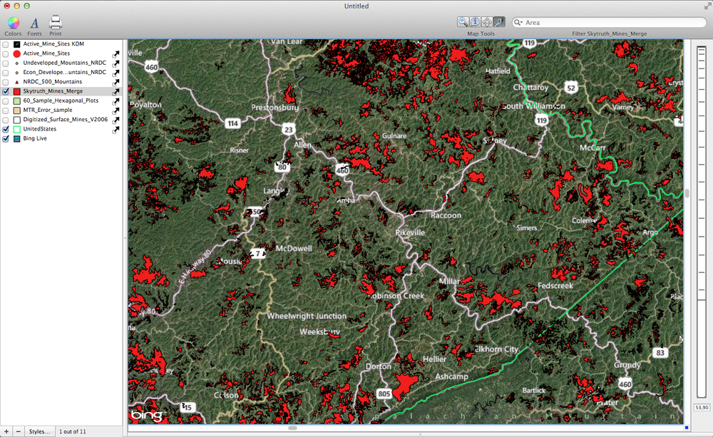
The final maps show the mines as digitized polygons highlighting the amount of area taken up by the mines. This is the Skytruth_Mines_Merge layer.