- Tue 21 August 2012
- Featured Maps
- Rick Jones
Drought conditions and high temperatures throughout the world are causing problems with wildfires. There are presently several thousand wildfires burning throughout the world, which have resulted in millions of dollars worth of damage. NASA has made available a set of shapefiles that identify the locations of wildfires presently burning throughout the world. The shapefiles are nearly real-time with data available at time intervals of 24 hours, 48 hours, and 7 days. Click on the following link to Download the wildfire data.
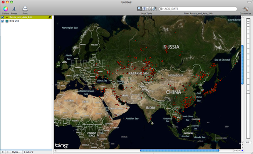
For this post I downloaded the wildfire data from Russia and Asia. Once the data are downloaded import them into Cartographica by choosing File > Import Vector Data. I provide an image below of the map of Russian and Asian wild fires.
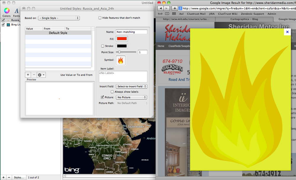
To enhance the fire map you can change the point symbols from circles to an actual fire symbol. To do this go to Google and perform an image search for "Fire". You will be able to find an image that can be dragged to the Layer Styles window. To open the Layer Styles window double click on the Russia and Asia fire layer in the Layer Stack. Then drag the fire image to the symbol box within the Layer Styles window. Once the image is added uncheck the stroke box. See my images below.
Below is an image with the fire symbols.
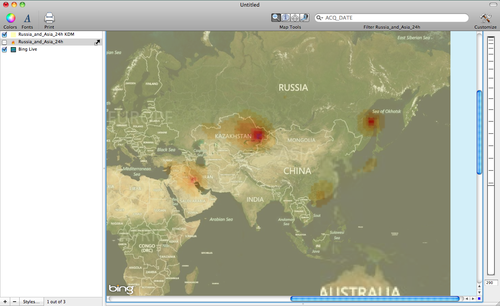
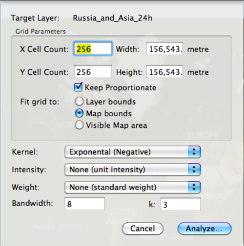
A final map shown below was created using the Kernel Density function. To create a Kernel Density map choose Tools > (while holding down the option button) Make Kernel Density Map. Choose the Exponential (Negative) function and click Analyze. I provide an image of the Kernel Density window below.
My final map shown below is of the Kernel Density of wild fires in Russia and Asia. To change the color scheme choose Window > Show Color Palettes. Select the color scheme you would like to use and then click and drag it to the KDM layer in the Layer Stack. The color scheme I selected is a custom color scheme called Fire Ramp.